Self-guided walk
The viewpoints walk
From the postcard view through the chestnut trees to the full panorama of the city. This walk has climbs, but every one of them buys a better view.
By Cesar Rodriguez · updated
- Time
- ~2 hours
- Distance
- ~4-5 km
- Difficulty
- Moderate (climbs)
- Pram / wheelchair
- Not suitable (climbs)
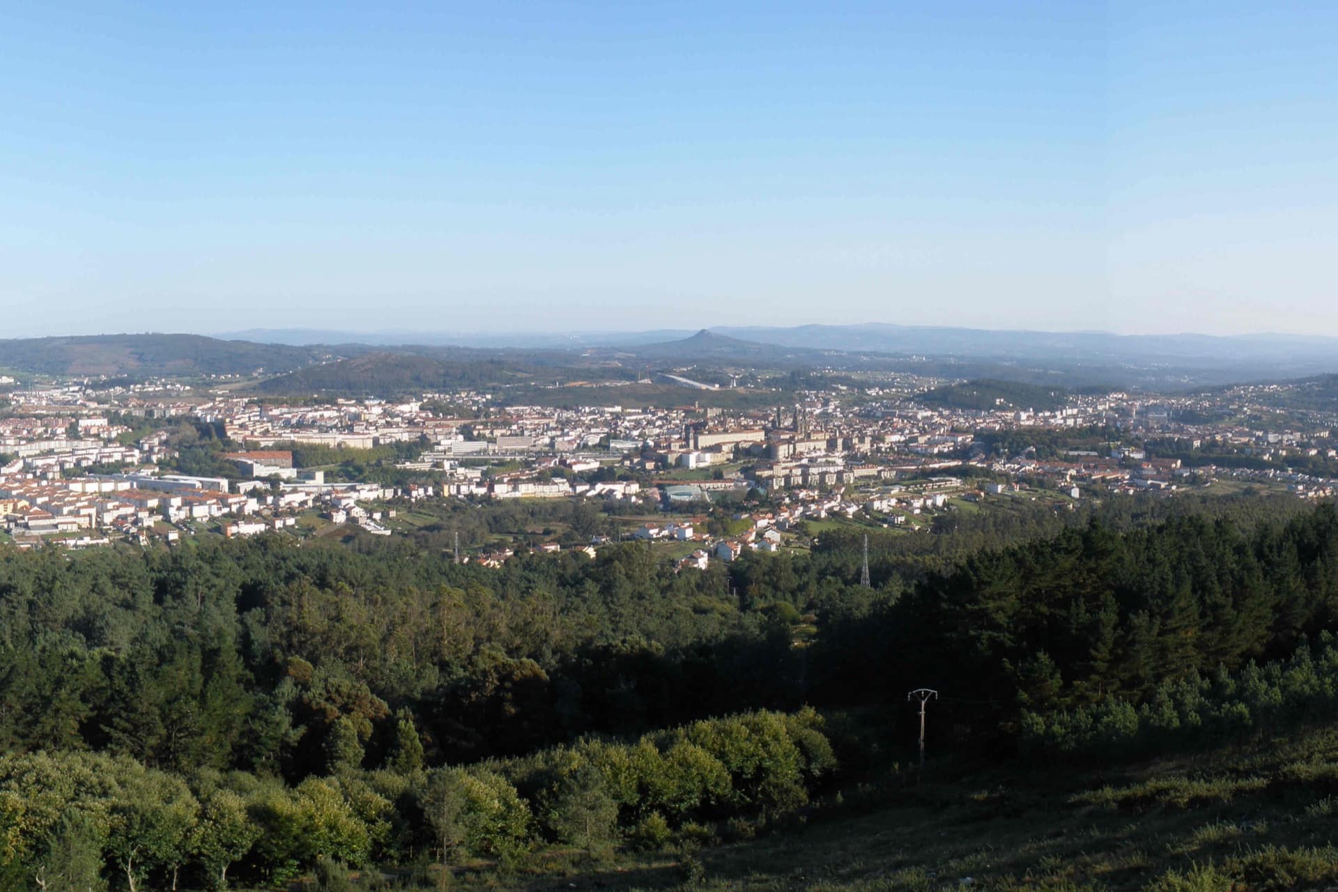
Santiago looks like a different city depending on how high up you are standing. This walk starts flat, in the Alameda, and gains height as it leaves the centre behind, finishing with the most complete panorama in the city from Monte Pedroso — the optional stretch, for anyone with the legs and the time to spare. You can do the whole thing or stop at the Alameda if all you want is the classic photo. If you would rather go up vertically than on foot, the city's other high view is the Cathedral roofs, 72 metres above the square, though that one needs a ticket.
- Parque da Alameda. The starting point, five minutes from the Obradoiro down Rúa do Franco. It is a public park in three parts: the Paseo da Alameda, the Carballeira de Santa Susana — a stand of century-old oaks — and the Paseo da Ferradura.
- Mirador dos Namorados, on the Paseo da Ferradura. The most photographed view of the Cathedral: the Obradoiro facade rising between the chestnut trees, seen from a bend in the horseshoe-shaped path that gives it its name. Go in mid-afternoon, with the light already low: that is when the stone stands out best between the treetops.
- Carballeira de Santa Susana. A short detour inside the same park, shaded and quiet even in the middle of August. A good place to sit for a while before taking on the steeper part.
- Belvís and Bonaval (the short alternative). If you would rather not climb Monte Pedroso, drop down to the Belvís park and carry on to the Bonaval hill, designed by the architect Álvaro Siza: from its upper end, next to the CGAC, you get the roofline of the old town from an angle almost nobody photographs.
- Monte Pedroso (the long stretch, optional). About 3 km north-west of the centre — you can place it beforehand on the map of Santiago — and around 20 minutes by car through the Vidán neighbourhood, opposite the Hospital Clínico. On foot it is close to 45 minutes of steady climbing from the Alameda. The reward is the only panorama that shows the whole of Santiago, old town and new, in a single glance.
Take it on paper
Print this page or save it as a PDF before you walk out of phone coverage.
Keep reading
Another walk
The squares walk
If you would rather have something flat and short, this route takes in the Cathedral's four squares in an hour.
The other high view
The Cathedral roofs
A guided climb across the granite roof of the Cathedral, 72 metres above the Obradoiro. Ticketed.
The full guide
What to see in Santiago
The complete route through the old town, with opening hours and prices for every monument.